Have you ever thought about how cities decide where to build new parks or how farmers know the best spots to grow crops? The answer lies in a tool called Geographic Information System, or GIS.
GIS is used in many industries because it helps collect, analyze, and visualize spatial data. It started with basic tasks like map-making and data collection, but has now expanded into fields like urban planning, agriculture, and disaster management. To work with GIS, professionals need a strong understanding of spatial sciences, problem-solving skills, and the ability to connect theory with real-world GIS applications.
In this blog, we will take a look at some of the most common ways GIS is being used today.
Understanding GIS and How It’s Used
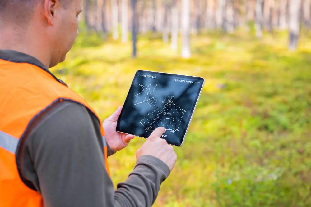
GIS, or Geographic Information Systems, helps make sense of data by showing it on a map. It brings together different layers of information to help visualize patterns and relationships. Instead of looking at numbers in a spreadsheet, GIS allows you to see how things connect in a specific location. It can be used for anything from mapping land boundaries to analyzing soil quality or figuring out the best route for a new road.
GIS technology has come a long way. What once required specialized desktop software is now available on mobile apps, cloud platforms, and even drones that capture detailed images from above. With these advancements, GIS is no longer limited to experts. It is being used in more industries than ever before, making it easier to understand and manage everything from city planning to environmental changes.
Components of GIS
GIS works through software, hardware, data, people, and methods. Each part plays a role in making sure geographic information is collected, analyzed, and used in a meaningful way.
-
GIS Software
The software is what allows GIS to function. It provides the tools needed to analyze and visualize spatial data. With the right GIS software, users can manipulate information, create detailed maps, and uncover patterns that help in planning and decision-making.
-
Hardware
Powerful software needs equally strong hardware to run smoothly. High-performance computers and specialized servers are used to process large datasets and create detailed visualizations. Both hardware and software must work together to ensure accurate and efficient handling of geospatial information.
-
Spatial Data
Data is the foundation of GIS. It includes everything from maps and satellite images to detailed property and land-use records. This information helps users understand landscapes, track changes over time, and make informed decisions about land development, conservation, and resource management.
-
People
GIS is only as useful as the people who use it. Real estate professionals, urban planners, government agencies, environmental analysts, and many others rely on GIS to study land, create custom maps, and conduct detailed research. The way GIS is applied depends on the needs of its users, whether it’s for mapping city infrastructure, analyzing farmland, or monitoring climate change.
-
Methods
Collecting and analyzing data requires a structured approach. GIS relies on different techniques to gather and process information, from remote sensing and aerial surveys to field research and spatial analysis. These methods ensure that the data being used is accurate and reliable, making GIS a trusted tool across different fields.
20 GIS Use Cases
Here are some GIS Applications in practical ways.
-
Urban Planning
Governments rely on GIS to plan cities and manage land use. Whether it’s designing roads, zoning areas for construction, or preparing for natural disasters, GIS helps make urban areas more organized and sustainable. For example, California uses GIS to plan fire response strategies, while Arizona manages its nine million acres of state land with GIS-based mapping tools.
-
Weather Forecasting
With extreme weather events becoming more common, GIS plays an important role in tracking and predicting them. Meteorologists use real-time GIS data to monitor storms, floods, and heatwaves. This helps businesses and emergency services prepare in advance, reducing damage and disruption.
-
Business and Decision-Making
Companies use GIS to improve operations, whether it’s managing deliveries, optimizing routes, or analyzing customer locations. In field service management, GIS helps businesses track technicians and schedule maintenance work efficiently. This reduces delays, improves customer service, and lowers costs.
-
Agriculture
Farmers use GIS to monitor soil conditions, track crop health, and plan irrigation systems. By analyzing satellite images and climate data, they can decide when and where to plant crops for the best yield. In Texas, sensors placed in the soil provide real-time moisture data, helping farmers reduce water waste while improving productivity.
-
Utility Management
Electricity and water providers use GIS to track their networks and prepare for weather-related disruptions. By mapping power lines and pipelines, companies can prevent service failures and respond quickly to outages. GIS also helps predict energy demand, ensuring a steady supply even during peak hours.
-
Climate Change Monitoring
Scientists use GIS to study climate patterns and predict environmental risks. Governments rely on this data to create policies that address deforestation, rising sea levels, and air pollution. GIS also helps decide the best locations for wind farms and solar panels, making renewable energy planning more precise.
-
Energy Sector
GIS plays an important role in energy production and distribution. It helps in planning power plants, finding efficient routes for power lines, and assessing land for wind and solar energy projects. It is also used in nuclear energy to create safety plans for evacuation zones and waste disposal sites.
-
Government Policies and Public Services
Governments use GIS to improve public services, such as emergency response, taxation, and infrastructure management. GIS helps in redrawing electoral districts, tracking voting patterns, and improving border security. It also assists fire, police, and ambulance services in reaching locations faster during emergencies.
-
Telecommunications
Telecom companies use GIS to plan mobile network coverage, identify areas with poor signals, and expand their services. It helps improve connectivity by ensuring better placement of cell towers and fiber-optic cables.
-
Smart Cities
Many cities use GIS to improve traffic management, waste collection, and public safety. It helps in monitoring pollution levels, planning public transport, and managing urban development in a more organized way.
-
Environmental Management
GIS helps in tracking deforestation, protecting endangered species, and managing water resources. Conservationists use satellite images and GIS tools to monitor changes in ecosystems and plan conservation efforts.
-
Water Management
Governments and industries use GIS to track water usage, detect leaks, and manage water distribution systems. It also helps in predicting droughts and ensuring a sustainable water supply for growing populations.
-
Disaster Management
Emergency response teams use GIS to assess risks and plan disaster relief efforts. Whether it’s earthquakes, hurricanes, or floods, GIS helps first responders locate affected areas and deliver aid efficiently. After a disaster, GIS helps in rebuilding efforts by mapping damaged infrastructure.
-
Healthcare and Disease Control
Hospitals and health organizations use GIS to track disease outbreaks and plan healthcare services. During pandemics, GIS helps visualize the spread of infections and allocate medical resources where they are needed most. It also assists in locating areas with limited healthcare access.
-
Navigation and Transportation
GPS navigation relies on GIS to provide accurate routes for drivers, cyclists, and pedestrians. Logistics companies use GIS to plan delivery routes, reducing fuel costs and improving efficiency. Public transportation systems also use GIS to optimize bus and train schedules.
-
Natural Resource Management
Forestry and mining industries use GIS to map forests, track wildlife, and locate mineral deposits. By analyzing environmental data, companies can extract resources while minimizing damage to the ecosystem.
-
Mineral Exploration
Mining companies rely on GIS to identify locations rich in minerals and metals. By analyzing geological data, they can plan exploration and extraction processes more efficiently.
-
Land Records and Property Management
GIS is widely used in maintaining land records, tracking property ownership, and planning real estate development. Governments use GIS to update maps, resolve land disputes, and manage urban expansion.
-
Supply Chain and Logistics
Businesses use GIS to track shipments, monitor inventory, and plan supply routes. It helps in avoiding delays and reducing transportation costs.
-
Military and Defense
GIS is widely used in military operations for mapping terrains, planning troop movements, and monitoring borders. It helps in improving national security by providing real-time intelligence.
Get Started with NEXGEN + Esri
Discover how NEXGEN’s GIS-powered asset management can transform your operations. Visit NEXGEN or schedule a personalized demo today.
Frequently Asked Questions (FAQs)
-
What are some common uses of GIS in different industries?
GIS is widely used in various fields, including:
- Mapping and navigation
- Telecom services
- Urban planning and smart city projects
- Environmental and water management
- Agriculture and crop monitoring
- Disaster response and risk assessment
- Healthcare and resource management
- Mineral exploration and land records
- Banking, digital taxation, and supply chain management
- Military and defense operations
-
How dos GIS help in urban planning?
It helps planners design cities while reducing damage to existing buildings and natural spaces. With high-accuracy maps, urban planners can make better decisions and create well-structured city layouts.
-
What is the role of GIS in disaster management?
GIS helps authorities assess risks, track real-time data, and make quick decisions. It analyzes geospatial and socio-economic information, allowing early response and better disaster preparedness.
-
How does GIS support environmental management?
It helps monitor environmental changes, track pollution, and manage resources. Conservation efforts, waste control, and disaster response become more efficient with GIS data.
-
How does GIS improve agriculture?
Farmers use GIS to monitor crops, predict yields, and manage soil conditions. It provides data on topography and soil quality, helping them choose the right crops and boost productivity.
-
What is GIS used for?
GIS collects, manages, and analyzes geographical data. It helps in mapping, decision-making, resource management, and infrastructure planning across various industries.